Fourteen local and Noongar artists will create 20 public art pieces across five new stations on the METRONET Morley-Ellenbrook Line Project - making it the largest art collection commissioned on a METRONET project to date.
The artworks are delivered under the METRONET Public Art Strategy. The artworks reflect and celebrate the unique environment of each station, as well as Noongar culture and connection to Country, to make each station a welcoming area for local communities while supporting opportunities for emerging and established artists.
Find out more about the public art planned for the Morley-Ellenbrook Line on the fact sheet.
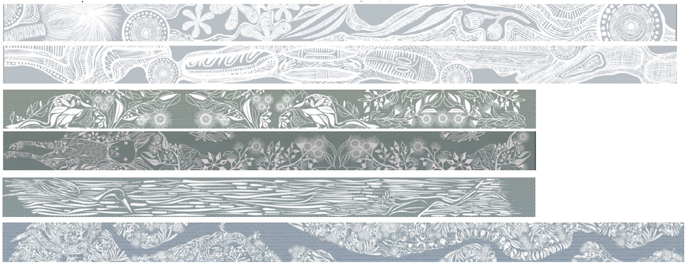
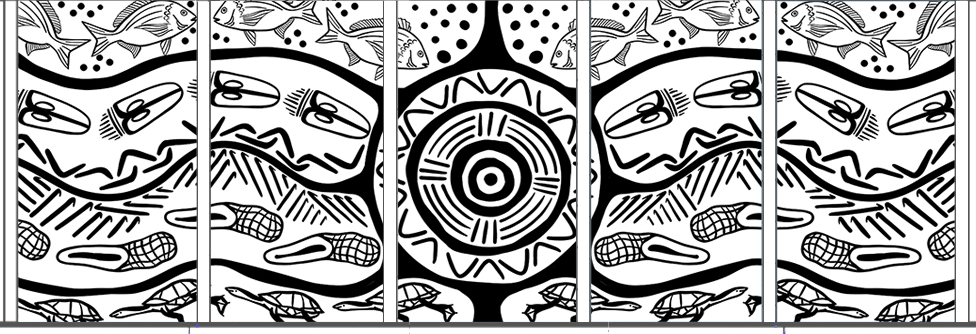
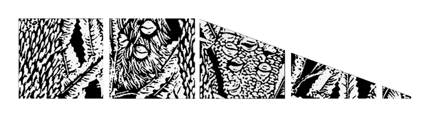
Station skylights
A series of graphically overlaid skylights will be featured at each of the five station. These pieces share and honour concepts of aboriginal and non-Aboriginal beliefs and are unique to each station.
Artwork by Marcia McGuire and Penelope Forlano
Ellenbrook Station
Screens
Metal arbour screens will welcome visitors and commuters to Ellenbrook Station, representing it as a ‘place of looking’ for the Whadjuk Noongar people. Two artists will create screening for the station, one drawing inspiration from Ellenbrook being a ‘place of looking’ and the other paying respect to the natural environment.
Artwork by Marcia McGuire
Artwork by Kamsani Bin-Salleh

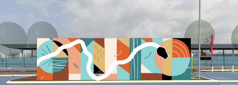
Bidi mural
A bright, bold mural will surround the station’s electrical building, representing the Karla Nara Gyinning Bidi (Ellenbrook train track). Bidis represent the seasonal movements of animals and people.
Artwork by Nathan Corunna and Darren Hutchens
Entry Sculpture
The sculpture reflects the concept of a ‘meet up’ and the comings and goings of commuters moving through the station - reimagined through a botanical lens. The design of the three connected forms is influenced by local flora and neighbouring pine plantations - mirroring a seed pod blown down from the tall pine forests, having collected a banksia seed along the way to create a hybrid botanical meet up that moves with the seasons and exchanging stories.
Artwork by April Pine

Whiteman Park Station
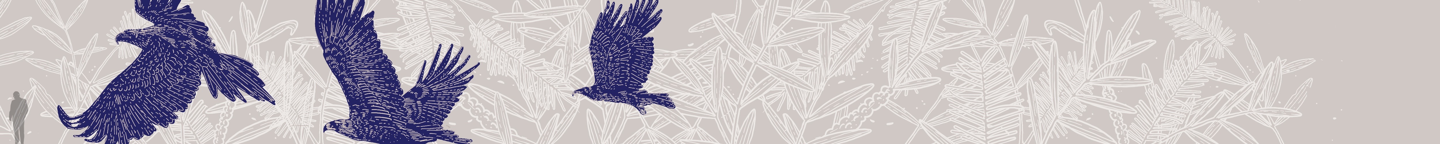
Entry mural
The entry mural will transform the walls around the station entrance with three giant wedge-tailed eagles in flight and abstract swamp and stout paperbark leaves and flowers.
Artwork by Jack Bromell
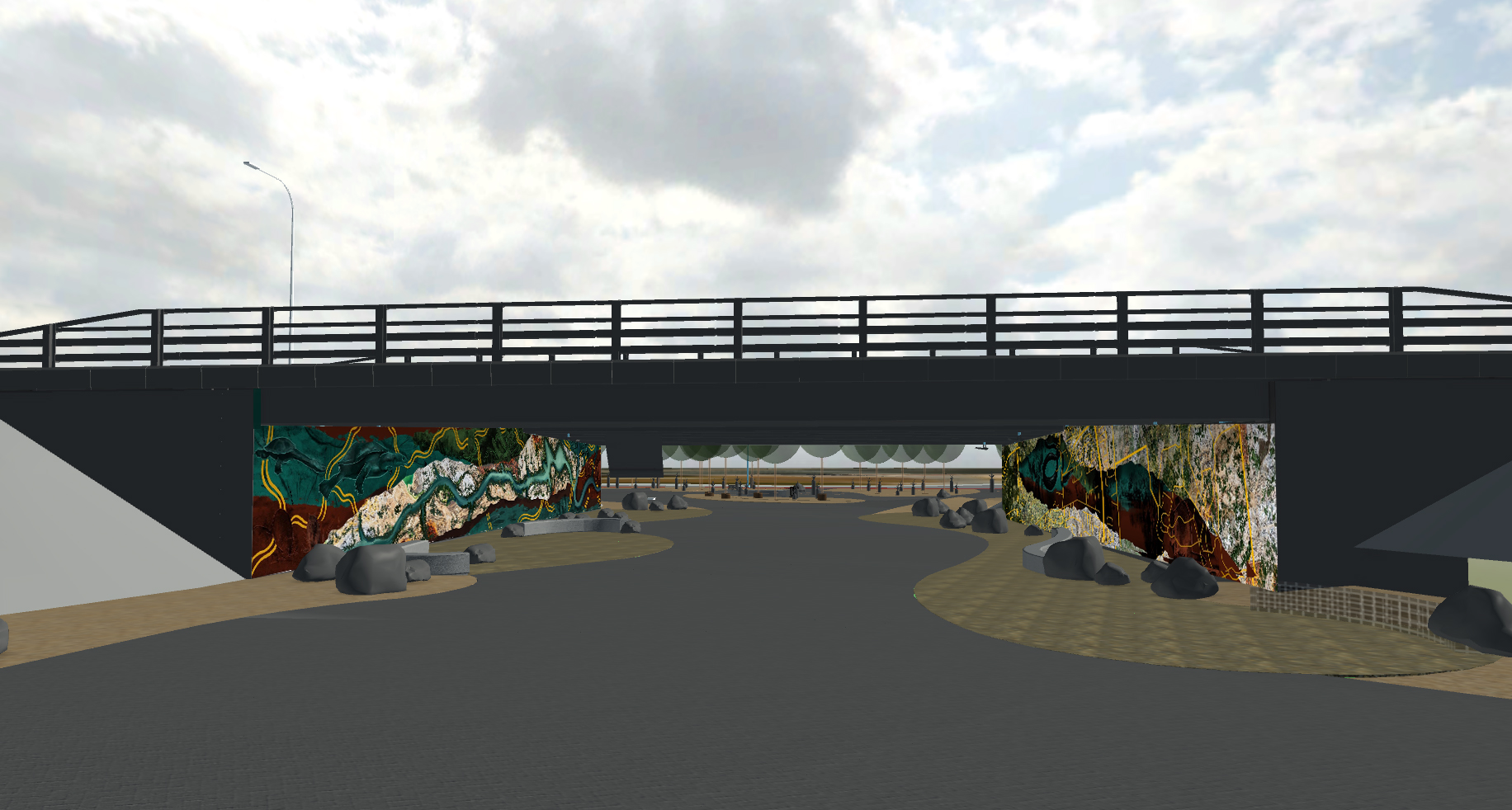
Underpass mural
With images emphasising the ecological and cultural importance of groundwater, this mural will brighten the Drumpellier Drive pedestrian underpass with representation of Bennett Brook stream, traditional Noongar pathways and Whiteman Park’s native flora and fauna.
Artwork by Rohin Kickett and Haylee Fieldes (Fieldey)
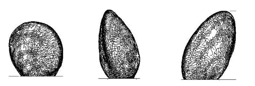
Marker sculptures
Two clusters of sculptural freshwater mussels will feature in landscaping around Whiteman Park Station. Connecting Whiteman Park Station to the freshwater mussels found in nearby wetlands.
Artwork by Pip Kelly
Ballajura Station
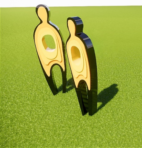
Arrival sculptures
Four unique sculptural artworks will be positioned in pairs to reflect how Noongar people and families travelled together on Country in search of food and water sources.
Artwork by Peter Farmer and Jason Hirst
Concourse and façade screens
Perforated screens will be located on the concourse of Ballajura Station. Two artists will create screens with different inspirations: one communicating Ballajura as a place of trading and the other drawing inspiration from the Banksia Tree.
Artwork by Marcia McGuire
Artwork by Mark Datodi
Noranda Station
Façade screens
Feature screens at Noranda Station will use abstract and bold shapes to celebrate the area’s New Holland Honey Eater, Flooded Gum and Moonah trees.
Artwork by Kyle Hughes-Odgers

Artist impression of facade screens at Noranda Station entrance
Underpass mural
Colourful banksia and wetland-themed murals reflect the native flora and fauna of nearby Lightening Swamp.
Artwork by Melski + Lilsiski

Morley Station
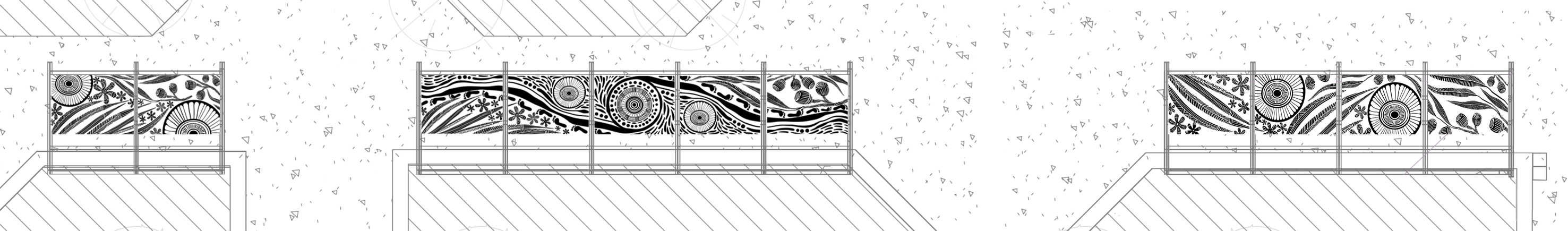
Arrival statement pieces
Three site-specific statement pieces will form a bold arrival statement at Morley Station. The blade wall, perforated screens and balustrade will represent Morley’s historical significance while acknowledging the new space of the train station.
Artwork by Haylee Fieldes (Fieldey)

Artist impression of Morley Station featuring blade wall and perforated screens
Bayswater Station
Mural
Engaging with Bayswater residents, artist Joanna Lamb will create a mural that features vignettes of plants and flowers from local gardens and wild bird life from the area, all expressed through lines, forms and colours.
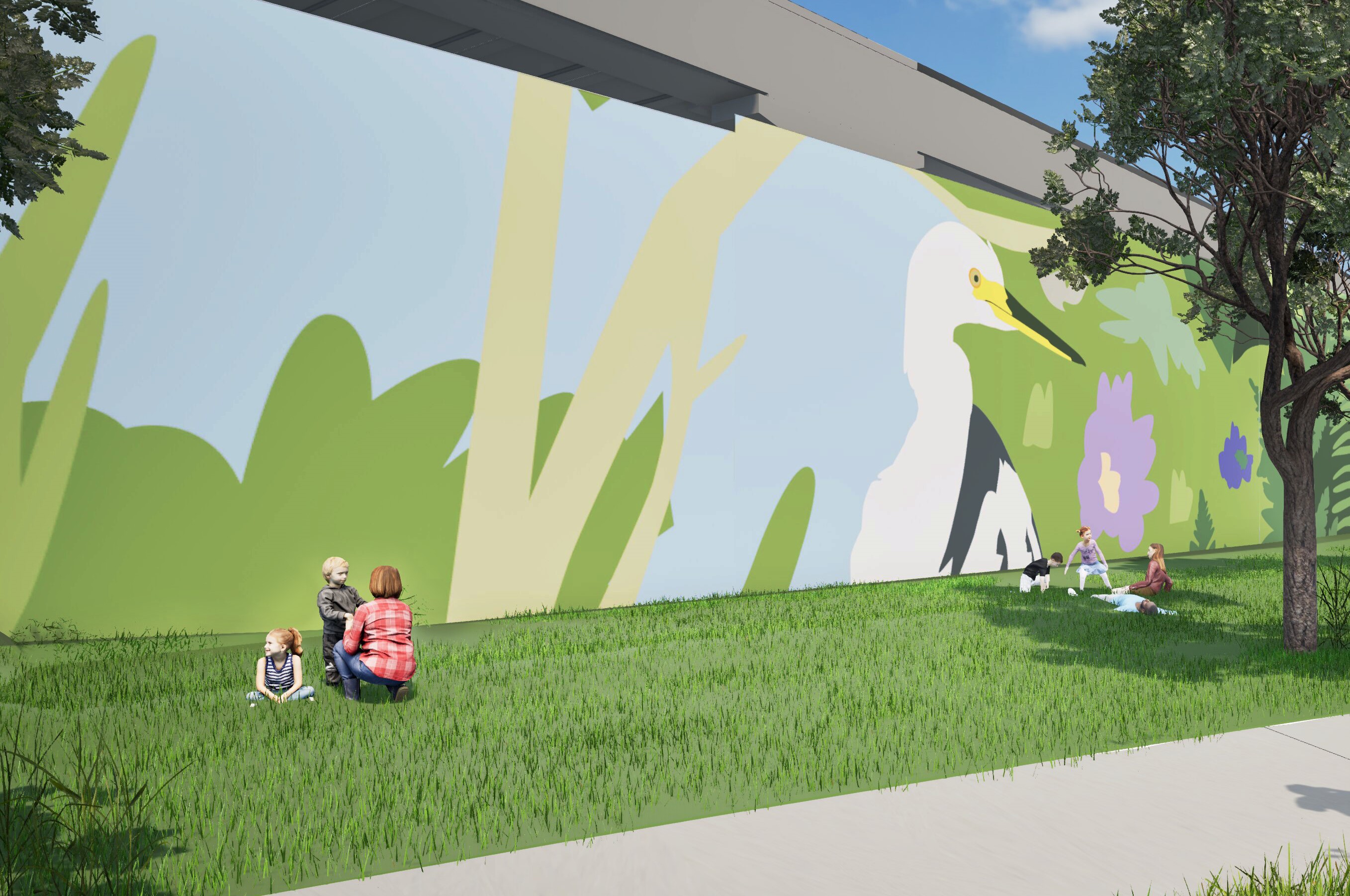
Artwork by Joanna Lamb