Stations

Stations

The Morley-Ellenbrook Line will provide 21km of new rail line from Ellenbrook to Bayswater, connecting to the Perth CBD, and will deliver five new stations, as well as planning for the areas around the stations.

The MorleyNorandaBallajura (formerly Malaga)Whiteman Park and Ellenbrook stations and the future station at Bennett Springs East will give communities more transport choice. The precincts around each station will be planned to provide access to more housing, jobs, community services, tourism and recreation opportunities over the next 30 years.

The Morley-Ellenbrook Line will spur from the existing Midland Line via the Bayswater Connection.

Morley Station and Precinct

Morley Station is located within the Tonkin Highway median under the Broun Avenue bridge and will connect passengers to the Morley Galleria shopping precinct, surrounding businesses, and the local community through frequent bus services.

The Noongar place name for Morley is Weeip and the narrative is ‘A leader, Birdiyia, of the Upper Swan region’.

A concept master plan for the Morley Station Precinct has been completed which sets the long-term vision for planning, development and infrastructure delivery for the area around the station over the next 30 years.

Incorporating feedback from the City of Bayswater, key stakeholders and the community, the Concept Master Plan sets out a vision for an urban village with a vibrant street environment and enhanced connections to Morley Galleria shopping precinct.

Download the Morley Station Precinct Concept Master Plan.


Read more about the station and precinct on the Morley Station fact sheet and the precinct fact sheet.

Noranda Station and Precinct

Noranda Station is located at Tonkin Highway and Benara Road and will deliver a reliable and efficient transport service for local and surrounding communities.

The Noongar place name for Noranda Station is Bohrnup and the narrative is ‘Place of the native chilli’. 

Future planning for the precinct around Noranda Station will be managed by the City of Bayswater.

Read more about the station on the Noranda Station fact sheet.

Ballajura Station (formerly Malaga Station) and Precinct

Ballajura Station (formerly Malaga Station) will provide efficient transport links to the surrounding suburbs and support future growth in the area. 

The station is located north-east of Tonkin Highway and Marshall Road junction and has been renamed Ballajura Station due to this geographical location and its connection to the Ballajura community.

The Noongar place name for Ballajura Station is Oordal Kalla and the narrative is ‘Clan of Yallagonga’.

A new footbridge will be built across Tonkin Highway in Ballajura, with access via the shared path along Tonkin Highway, close to the Premier Place access point on the western side. The footbridge will provide easy access to Ballajura Station and to Whiteman Park and improve connections for commuters.

Precinct structure planning is underway to guide the long-term planning of future roads, community facilities, schools, public space and land use in the area around the station.

Feedback from a community survey has informed the vision and roadmap for the future area around Ballajura Station and is helping shape the draft precinct structure plan.
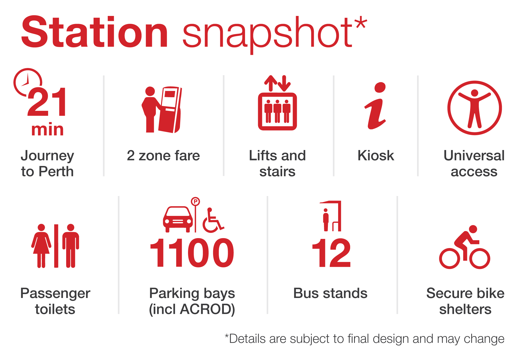
Read more about the station and precinct on the Ballajura Station fact sheet and the precinct fact sheet.

Whiteman Park Station and Precinct

Whiteman Park Station is located alongside Drumpellier Drive, just south of the Whiteman Park entrance. The station will provide transport services and modern facilities to the communities of Henley Brook, Dayton, West Swan and Brabham, including new transport options for visitors to Whiteman Park and the Swan Valley – two of Perth’s premier tourism destinations.

The Noongar place name for Whiteman Park is Wirrinup and the narrative is ‘A place with strong spiritual presence situated here’.

A concept master plan has been completed to set the long-term vision for the area around the station. This plan will support growth in the area over 30 years and sets the high-level road map for the urban development east of Whiteman Park Station and recreational and tourism areas to the west in keeping with Whiteman Park’s values.

Download the Whiteman Park Station Precinct Concept Master Plan.

Read more about the station and precinct on the Whiteman Park Station fact sheet and the precinct fact sheet.

Ellenbrook Station and Precinct

Ellenbrook Station is in the heart of Ellenbrook’s town centre, located south of The Parkway and west of Civic Terrace. The station will offer a new transport option for the 46,000 residents living in the area. It has been designed to support this growth, while making the most of vacant land around the station.

The Noongar place name for Ellenbrook is Karla Gnara and the narrative is ‘Firestick farming or consumption (eating) by fire’.

Future planning for the precinct around Ellenbrook Station will be managed by a State Government and private sector joint venture.

Read more on the Ellenbrook fact sheet.


Bennett Springs East Future Station and Precinct

With a potential future station planned for Bennett Springs East, there is an opportunity to urbanise the surrounding area with complementary transport, housing, and recreation choices within the station precinct.

To support this change, precinct structure planning is currently underway to establish the long-term planning framework that will guide the future development of local roads, housing density, zoning and locations for community facilities such as schools, shops and public space.

The Noongar place name for Bennett Springs East Station is Ketinup and the narrative is ‘Place of the freshwater mussel’.

Latest News

Ellenbrook Station achieves world leading 6 Star Green Star certification

Ellenbrook Station achieves world leading 6 Star Green Star certification

The new Ellenbrook Station, being built as part of the METRONET Morley-Ellenbrook Line Project, has achieved a 6 Star Green Star - Railway Stations v1.1 certification, making it the highest rated under this tool.

Morley-Ellenbrook Line first test train

Morley-Ellenbrook Line first test train

The METRONET Morley-Ellenbrook line has run its first test train. The 21-kilometer line will connect the north-eastern suburbs to train services, offering transport options to the Airport and broader Perth train network.

Indigenous Inclusion Award for Morley-Ellenbrook team

Indigenous Inclusion Award for Morley-Ellenbrook team

The METRONET Morley-Ellenbrook Line Project team have been recognised for their outstanding work on Aboriginal inclusion and participation, with project contractor Laing O’Rourke awarded the Indigenous Inclusion Award.

Sustainability at the forefront

Sustainability at the forefront

The Morley-Ellenbrook Line Project is focused on working more sustainably to reduce carbon impacts of materials by more than 15 per cent, improve resource efficiency and support a circular economy by using recycled materials. 

Back To Top